Posts

About the project

One thing that I just realized is that I haven’t explained what my capstone project is. I am sure that I gave out a link or two so those people will know what I am posting about but what about people stumble on this by accident. So here is the run down on my project. The school that I go to CSU Channel Islands was given money via a grant called B-Wet. This allowed college students to work with high school and middle school students that are underrepresented and to lend them a helping hand in learning about the environment. This portion of the grant is called crossing the channel; this is more of the general of college students helping with high school and middle school aged students. The part that I am helping with specially is the educational portion of the grant. Myself and another capstone student are working with Channel Islands High School and R. J. Frank Academy of Marine Science and Engineering. During the time of the two semesters or the whole school year using a curriculum created by NOAA called LiMPETS, this time was spent teaching the students about the amazing channel that is in their backyard. The people were during this was our advisor Chris, a graduated student (MJ) a fellow CI student named Dulce, fellow capstone student Erika and myself. Erika and Dulce are working with the middle school students; MJ and myself are working with the high school students, lastly Chris goes between both schools and helps us all along. The first lesson we taught was that we split the classes into groups where they needed to do research into a group and animal that both use the channel for different reasons. The groups needed to then present their findings to the class and place a representation of animal where they could be found. After that lesson, Erika and I taught a lesson to the classes about how limited the resources are on our planet. Then Chris, Erika and I taught the classes about how watersheds work and how much pollution can get into the watershed system. This was all done during the past semester.


During this semester Erika and I will be teaching an entire until ourselves. This is where the LiMPETS program comes in. This program was made to get students out of the classroom and out into the field to do some citizen science. The science that the students will be participating in will be looking at intertidal zone and sandy beach. In the intertidal area they are going to be identifying a number of invertebrates and algae’s. They will also be counting and measuring the sizes of Owl Limpets. These are going to be counted and measured because over the course of time people have gotten into the habit of taking these creatures off and eating them. To see how big the limpets get without being taken off and eaten. They also count and Ochre Sea Stars, they are counting these because the sea stars are keystone species because they keep the sea mussel downs. That is what the students will be doing in the intertidal area. Then there the sandy beach stuff. The students are going to try to get sand crabs and measure them, and record all of the measurements of the shells. The students then put the sand crabs back into the sand. That is what the students will do. This will all be done at Carpentaria State Beach on February 18th and 19th.


Do get everything all ready for this all to happen. Erika and I have been working really hard in getting together packets for the students to work on so that they can all hopefully retain the information that we have been giving them. We have been working on lessons and PowerPoint’s for us to give to the students. We have been making plenty of meetings with our advisor Chris and with him giving us plenty of advice on how to continue. So over all everything is going well for me, just got to get through it all.

starting up again

My partner and I have been working hard getting our lesson plans done and the research packets the students will be working on. I have also been working on the survey I will be giving the students for my data collection for my capstone. Starting February 5, 2016 I will be going to the middle school to start unit 3. I am excited to start this unit and collect the data I need.

Winter Break Update

Over winter break I have collected a good amount of data through weekly testing. High water flow due to the first El Nino event on January 6 allowed me to use the sonde to collect data directly but recently lack of rain has reduced flow so I have been bottle sampling and testing manually. The lack of water flow has increased levels of chlorophyll, conductivity, total dissolved solids, dissolved oxygen, and pH while turbidity has decreased. I will continue to analyze these levels and convert them into a few graphs this week.

Site SB02, January 6, 2016
Site SB02, January 29, 2016

Update 1/31/16

The Spring semester has just begun and research is getting back into full swing. Over the break I was scheduled to depart to Santa Rosa Island for a week.  Unfortunately the weather had different plans and with multiple craft advisories and high seas the trip was scraped. My partner was able to attend the second trip scheduled and finished the last part of field research with the help of another student.

As for this semester the majority of my time will be shifted to the GIS analysis and work. I have begun brushing up and researching the necessary spatial analysis tools and programs. The school has also purchased, what I believe are the last 2 remaining aerial images needed for the final project. This week I plan to get in touch with my research advisor and partner.

Census Finished!

Over winter break i mad a seven day trip out to the island and made some huge progress on my research.  Brice and I finished our census of the BIshop pine trees, there were about 2200 trees, and now its time to analyze data.    While I was on the island i also collected seeds from 25 different trees that I am going to use in a common garden experiment.  I still have to travel up north to a stand of Bishop pines in Lompoc to gather seeds from 25 more trees in order to do a comparison of mainland trees to the Santa Rosa population.  This garden is going to be a long hard experiment but i will keep you updated with all the fun.

IMG_20160117_083143_175

The weather was pretty intense out there this trip as well, finally got some surf on this side of the island.

IMG_20160118_071809_740

Offshore Fracking Halted Temporarily

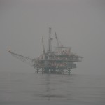
Oil Platform Santa Barbara Channel 10-22-05

The Santa Barbara Environmental Defense Center’s 2014 challenge to Interior’s policy of offshore fracking with limited public notice has met with success by the courts.  The Bureau of Ocean Energy Management (BOEM) and Bureau on Safety and Environmental Enforcement (BSEE) have agreed to re-analyze the environmental dangers of offshore fracking, with their environmental impact assessment of the process/policy to be completed by May 28, 2016.


Oil fracking off the Ventura and Santa Barbara coast has been halted for at least a few months.

Source: Government Agrees to Halt Offshore Oil Fracking Off Coast

Brief Overview of My Research and Winter Break Recap

In Fall 2015, I started my capstone project on vegetation distribution on Water Canyon Watershed on Santa Rosa Island. Prior to this project, I knew a very minimal amount of plant species. I spent many days both on the main land and island researching and learning different plant species. The beginning of the semester was a challenge. I barely knew any plants, so I was taking pictures of every species I found. I was then going back to plant experts, as well as looking them up online, to find out what the species were. I am now confident when identifying species in my transect, with the exception of annual grasses. While conducting research, I identify the species to the genus and sometimes the species. To keep my accuracy of identifying species high, I categorize annual grasses in a group.

DSC_2018

After visiting the island five times during the fall semester, I ventured out again for a week over winter break. During this week long trip, I was able to finish up surveying the watershed. I have 25 sites throughout the watershed, starting at the upper reaches and ending near the ocean. At each site, I capture data for two terraces and anything that falls between them, floodplains, stream channels, etc. Prior to this trip, I was unsure with some of my previous data collected. I was able to go back to those sites and resurvey with my modified methods. I now have a complete set of transects for the watershed. 

I have one more week long trip planned for spring break. During this time, I will double check my transects and make sure I have all the correct data. I will also be putting in rebar, so future studies can find my sites. In the mean time, I will be entering and completing my data sheet. I am now moving towards the process of writing my methods and processing my current data.


COMPLETED ALL DATA COLLECTION ON SRI!

I have completed all of my data collection on Santa Rosa Island (SRI). I went to SRI for a whole week from January 12th to the 19th. My two partners, Karen Ramirez and Jazmine Cureno, and I finished collecting data from the demography plots, created by Travis Hall and Andrew Brinkman, and collecting SRI Torrey pine pinecones for my common gardens experiment. Thanks to my partners, I was able to collect all my data and pinecones just in time before we had to return to the mainland!

Below I have attached a video of my field research on SRI.


An Unexpected Find

IMG_4636

While I was out in the field for the week long trip, I was looking through all the plants I came across and I took detailed photos of those plants that I didn’t recognize in order to learn the flora of the island a little more and also properly catalog them if they turned out to be invasive plants. I took a photo of a very thick unusual looking plant that I found a large concentrated population of near one of the historical buildings. Later on, I was looking at Calflora to see if there was a difference in the iceplant species that are on the island due to differences in their flower colors. While scrolling through the iceplants, I saw the thick leafy plant I had earlier photographed! I would never have suspected that to be Crystalline Iceplant; it just looks so different from the iceplant we see everywhere else. I later confirmed that it was crystalline iceplant by comparing it to Sean Clark’s pressings of the plants on the island. I then got some good data about the location and spread of the Crystalline Iceplant. Hopefully since they’re mostly young growths, this is being caught early enough to manage before it gets out of control.

Learning From Mistakes

sidebysideAs embarrassing as this is, it was a very valuable lesson for me so I thought I’d share a careless mistake I made during my research. Before this week long trip, I’d prepared a Plant Identification Chart with photos from Calflora.org and CalPhotos.Berkeley.edu and descriptions of those plants. The one problem I overlooked with this is that the internet is no substitute to actually going outside and looking at these plants. So I started my search for invasive plants and on the first day I found what I thought was dried up invasive Sweet Fennel (Foeniculum vulgare). It was tough to tell what color the flower was because not many of the plants are in bloom around this time, so it looked brown and dried up. For the next few days I was charting hundreds of populations of the plant thinking there was a terrible infestation and not finding much else that was on my list or anything that even looked like what I was looking for. Several days in, another capstone student, Aimee Newell, had finished up early for the day so she came to check out what I was working on, being that she’s also looking at vegetation on the island. I then showed her the “fennel” that I was about to record and she informed me that what I had been so sure was fennel was actually a plant called Yarrow or Achillea Millefolium (and it was a native!). I’d done what I warned the kids at the middle school not to do and identified a similar looking native! With help from her and Cause, we were able to find an actual specimen of Sweet Fennel behind the bunkhouse with it’s biggest identifier being that it’s leaves smell like black licorice, something I didn’t learn from online sites. Lesson learned: ask questions early and ask them often! I will be contacting the NPS botanist for SAMO and confirming the plants I identified now that I’m back on the mainland.

In the photos above: left image of the plant in the field is Yarrow, right image of the plant against a white wall is Sweet Fennel.