El Capitan State Beach is currently slated to re-open to the the general public this Friday, June 26. El Capitan was heavily oiled beginning late in the day on May 20, 2015 (day 2 of the spill), but was nevertheless exposed to less intense oiling than Refugio State Beach. Refugio will remain closed for at least an additional two weeks while work crews continue to clean rocky intertidal of deposited tar by hand.
El Capitan State Beach has been cleared by the California Department of Parks and Recreation to re-open, Friday, June 26, 2015.
The California Department of Parks and Recreation and members of the Unified Command completed a site assessment of El Capitan State Beach and deemed it safe for the public, Thursday, June 18, 2015. While the beach will be open June 26 for camping and day use, State Parks personnel requests that campers do not check in until 12:00 p.m.
Reservations at Refugio State Beach have been cancelled until July 9. Additional reservations may be cancelled depending on the progress of the clean-up operation. State Parks staff will continue to monitor the cleanup and re-evaluate the closures. Any affected reservation holders will be notified by e-mail and voicemail of future cancellations. Campers with reservations that experienced additional impacts from the Refugio crude oil release should call the toll-free claims line at 1-866-753-3619.
The JIC remains very interested in telling you that everything is okay. They have unfortunately demonstrated a pattern of releasing essentially no information with any detail or with any timeliness. For example, while they are anxious for you to know El Capitan is opening back up, the most recent beach oiling map they will provide is nearly a week old.
Refugio Beach Oiling Map as of 06-16-15. Note: the Refugio-El Capitan region is the section with the most oil remaining (red and orange color herein). Source: Joint Incident Command
To be clear, our observations suggest there is little significant threat to beach goers in this region. But the lack of free flowing information and the massively superficial nature of most of the information released to date has been disappointing.
While the public access is slated to improve over the coming weeks, the prospect for routine oil pumping is limited. The oil movement infrastructure remains compromised. Plains All American has yet to comment on the date for the restoration of flow in this trunkline of their pipeline. Some folks are quoting a year to get it up and running, but don’t believe those silly timelines. Exxon’s request to move oil via increased tanker trucks has been stymied for the time being and the tank farm on the Refugio coast is now at full capacity. The three offshore platforms that feed into this facility have now been shut in and are not producing and petroleum.
KEYT 3 News Reports that four platforms are now shuttered in the wake of the Refugio Spill.
https://cikeys.com/wp-content/uploads/2022/09/CI-Formal-Logo_2A-flat-300x50-1.jpg00Sean Andersonhttps://cikeys.com/wp-content/uploads/2022/09/CI-Formal-Logo_2A-flat-300x50-1.jpgSean Anderson2015-06-21 11:53:422015-06-21 11:53:42Infrastructure Update: Things Opening Up
Check out what my students are doing now and have been doing in recent months with these killer new tools here: The AARR PIRatE Lab Blog. Several of them are exhibiting some of our flying and swimming units at the national DARPA Challenge finals all weekend in Pomona. We were invited to participate in this event by the DoD both due to our excellent outreach and educational efforts across all education levels (middle school, high school, and university) and for our pioneering efforts to use cheap, open source robotics to monitor the coastal zone. Combing the seafloor for oil is but our latest adventure and application for these powerful new tools for environmental assessment. See my students’ blog for what we have been doing and consider swinging by the event at the Pomona Fairplex in Pomona, CA today for the free-to-the-public demos and competition.
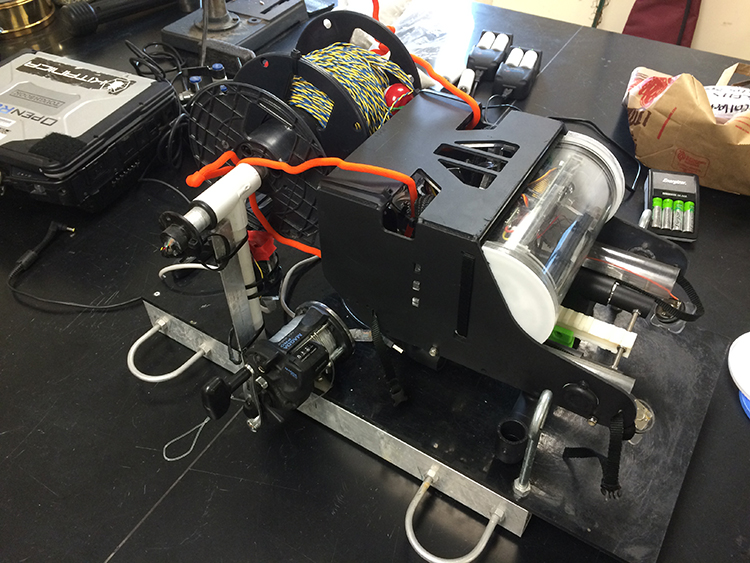
Open ROV 2.7: The Black Pearl on our custom launching platform.
What are we doing with robots?
We are using our cheap, small, open source robots to hunt for any evidence of deposited oil on the seafloor near the spill epicenter at Refugio State Beach on May 19. We are interested in assessing the ocean floor near the oil spill site for the presence and density of any subsurface mats, tarballs, oiled algal stands/seagrass meadows, or signs of potentially affected wildlife.
Getting there has been half most of the challenge
We have been pursuing access to the seafloor in the restricted access zone (the area upcoast and downcast from the Refugio pipeline break) for the past two weeks (see Pacific Standard’s piece on this very issue here) through all the formal and informal channels we know of. Daily calls and frequent electronic requests to the JIC and to incident command member agencies have gone nowhere and we still have not been granted access/permission to deploy our tools inside the immediate spill zone. This has been frustrating as we believe we have unique tools that can document deposited oil on the benthos and create a visual record of the amount for the permanent/legal record. Everyone we talk to seems to think our ROV (Remotely Operated Vehicle) survey is a great idea, but no one would pull the trigger to allow us or any of our partners access to the site.
As we have yet to secure legal permission to enter the area where oil was most likely deposited, we opted for the next best thing. This past Thursday we did a quick inspection of Naples Reef, a Marine Protected Area about 14 km (8.5 mi) from the Refugio spill and an area outside the restricted zone. Our Santa Barbara Channelkeeper colleagues have a keen and long-running interest in the goings on a Naples and have been anxious to confirm any (hopefully minor or non-existent) impacts to the reef.
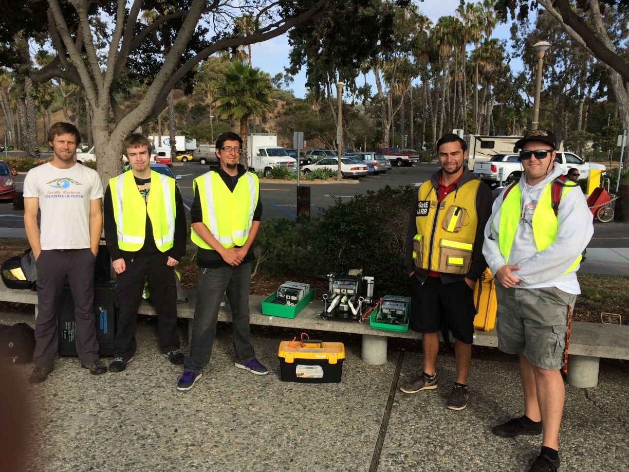
Ben Pitterle (Watershed and Marine Program Director, SB Channelkeeper) and our AARR oil spill team; Tim, Paul, Chris and Blake.
Our motley crew (well, technically we in the PIRatE Lab’s AARR group are motley…our colleagues actual professionals) set out Thursday morning from the Santa Barbara Harbor aboard the Santa Barbara Channelkeeper’s converted 31-foot JC lobster boat the R/V Channelkeeper.
R/V Channelkeeper en route.
A fantastic team
One of the best things about creating and using new tools such as our ROVs is the associated chance to meet tons of great new colleagues and partners. This initial hunt for benthic oil brought together three groups onboard the R/V Channelkeeper; our AARR team, Ben Pitterle from Santa Barbara Channelkeeper, and David Lang from OpenROV. Ben helms all things watershed and marine-related for Channelkeeper as their Watershed and Marine Program Director. David Lang is a co-founder of OpenROV and a partner on our current NOAA grant to educate K-12 students about our coastal environment via innovative curricula and tools (like ROVs). See our recent OpenROV Explorer’s Google Hangout for more info (we talk about looking for oil starting around the 15 minute mark).
Any Oil?
So the buried lead here is that we detected no oil, although this initial survey was quite preliminary. This is of course great news for Naples Reef and our nearshore environment! It is also no surprise as any deposited oil would be most likely be concentrated and therefore observable in the immediate shallow subtidal near the pipeline break up at Refugio. It is also important to note that with every passing day any deposited oil will likely become covered with sediment, detritus, etc. and be that much harder to detect with simple visual inspections.
A great test
This demo showed that our cheap ($1,000 baseline, $2,000 with our modifications) ROV can easily be used for subsurface surveys in the wake of oil spills. Even on a day with poor visibility thanks to the previous nights drizzle. Our small, OpenROV units are portable (fitting within a single Pelican Case or large backpack), adaptable (everything is open source and open to anyone to modify or adapt), and require minimal training (we can bring users up to speed in a handful of days). These units are also easy to assemble (we are doing builds now for various non-robotics savvy labs). Even we (our lab is pretty interdisciplinary but still dominated by ecologists, conservation biologists, and environmental scientists) can build these things…so you know they are user-friendly.
Lastly, it is key to reemphasize that these units could be considered expendable. We are not a wealthy lab by any stretch of the imagination, but sending tech into the sea is always a challenge. Sending tech into a natural disaster context on top of that already hostile milieu translates into a good chance you will lose or break something. We believe it is much better to put a $2,000 unit that can be operated by undergraduates on the case and in harm’s way rather than a several hundred thousand dollar unit requiring highly specialized operators, support staff, etc. This new tech we are proposing is both cheaper and much less riskier. It is even opening the door to potential citizen science groups monitoring swaths of our coasts, oil spill or no. How cool would that be?
This was a great proof of concept trial! We now know that we can indeed use our versatile OpenROV platform to go hunt for oil. We will be returning to sea next week to continue the hunt…hopefully with permission to enter the restricted zone. Keep you fingers crossed!
https://cikeys.com/wp-content/uploads/2022/09/CI-Formal-Logo_2A-flat-300x50-1.jpg00Sean Andersonhttps://cikeys.com/wp-content/uploads/2022/09/CI-Formal-Logo_2A-flat-300x50-1.jpgSean Anderson2015-06-06 15:49:492015-06-06 15:49:49Our ROVs: Prowling for Oil