The most dramatic changes at Port Hueneme can be seen at Transect 1. The top photo taken in October had a beach length of 90 meters to the edge of the scarp. Currently (2/27/16), the beach is 5 meters to the edge of the scarp. As the sand is migrating south, more and more riprap is becoming exposed. I predict that within the next few months, Transect 1 will be completely underwater and unable to survey with the automatic level.
Had a great time on Saturday working with Ventura Surfrider and Ventura Audubon to clean up the nesting area for the threatened Snowy Plover at Ormond beach. This is my second season working with the local nest monitor for the Western Snowy Plover and California Least Tern. I brought my niece and nephews out to learn about the habitat and why picking up trash is so important.
https://cikeys.com/wp-content/uploads/2026/09/ci-logo-ciKeys.png00Sean Andersonhttps://cikeys.com/wp-content/uploads/2026/09/ci-logo-ciKeys.pngSean Anderson2016-02-28 18:31:552016-02-28 18:31:55Ormond Beach Clean up for the Threatened Snowy Plover
This weekend I worked with kids from Robert J. Frank Middle School in the NOAA B-WET Program at the CI Boating Center. The kids worked on their scientific presentations and got a chance to kayak around the beautiful Channel Islands Harbor. Its great to see future scientists in the making!
https://cikeys.com/wp-content/uploads/2026/09/ci-logo-ciKeys.png00Sean Andersonhttps://cikeys.com/wp-content/uploads/2026/09/ci-logo-ciKeys.pngSean Anderson2016-02-28 18:27:122016-02-28 18:27:12Weekend with Science Kids
Our AARR Team was graciously invited to be a part of this year’s annual conference for the Gold Coast Science Network. This professional society for K-12 educators across our region of southern California draws their members from a area roughly bounded by San Luis Obispo County in the north, Orange County in the south, and inland as far as Kern County and the Inland Empire. In existence since the mid 1990’s, this year marked their 11th annual conference showcasing talks about the most recent approaches to imparting scientific discovery melded with dozens and dozens of practical teaching demos/hands-on lab development charrettes.
CSUCI’s Dr. Jerry Clifford runs a session on how he has successfully engaged middle school students in summer programs at El Rio by emphasizing exploration, estimation, and curiosity.
Showcasing AARR Robots
Forrest, Tim & Chase at our AARR Table.
Students from our AARR lab group were a hit at our demonstration table where we showed off a few of our aerial and aquatic robots we use for research and teaching. Forrest, Tim, and Chase did a fantastic job of showcasing our work and units while fielding any number of questions about the technology and how we use it to engage learners.
Plenary on Conservation Mechatronics
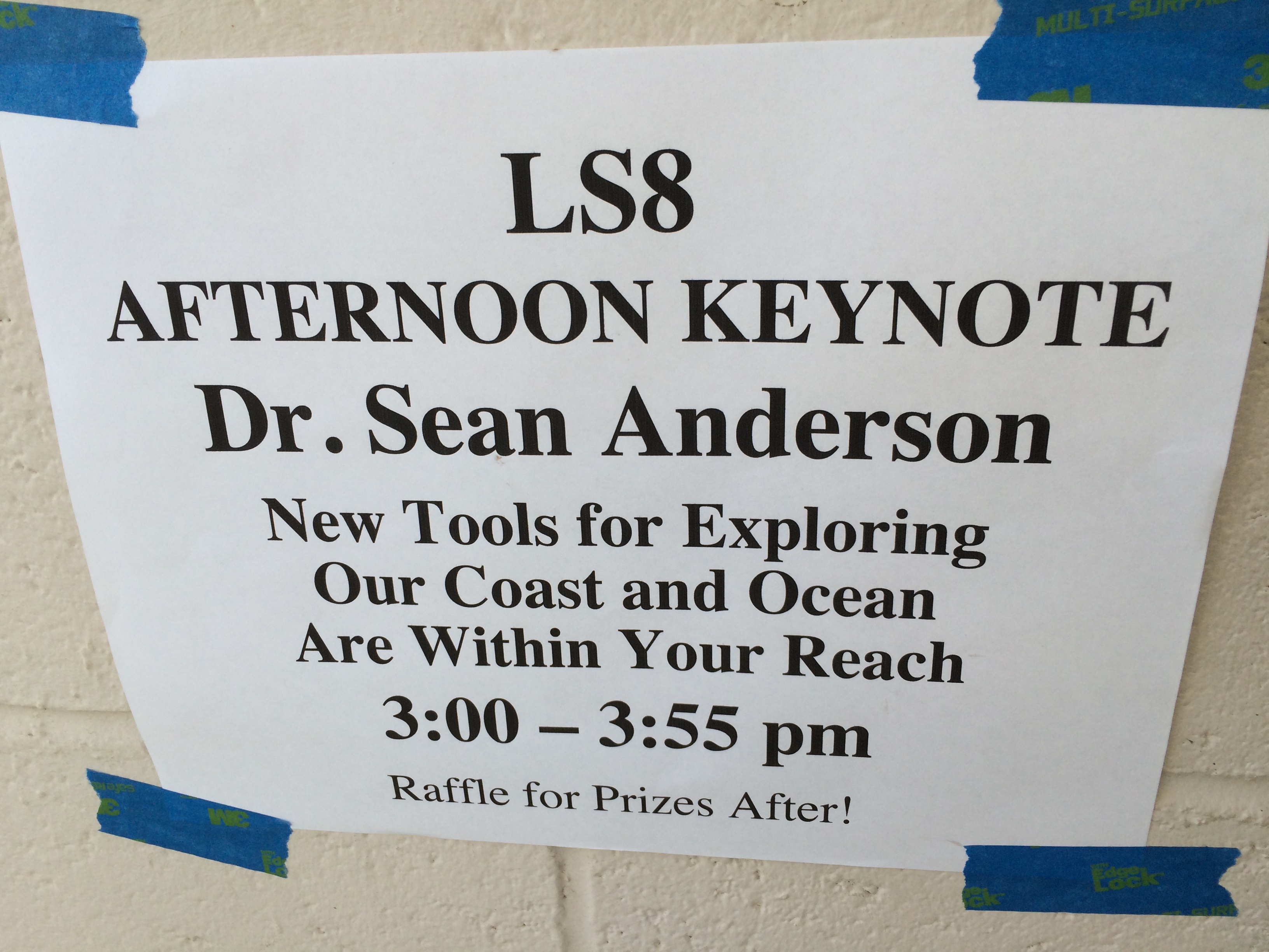
After a day of demoing and discussing all manner of robots and methods to captivate students with science, Dr. Anderson gave the closing plenary to a super packed auditorium with his typical, highly energetic zeal. It was the end of the day and a bit warm in the room, but those teachers were truly anxious to hear about all the great stuff we have managed to cook up at CSU Channel Islands over the last few years.
Screencast of Dr. Anderson’s plenary:
Dr. Anderson’s slides are free to download (via Research Gate) here.
Dr. Anderson’s Plenary Abstract:
A literal and figurative sea change is all about us. As our water world is facing unprecedented assaults from our burgeoning human population, a new panoply of tools is falling into our hands to help us better understand those changes. These tools offer us an unprecedented opportunity to explore our oceans with a precision and scope heretofore restricted to only the most cutting edge research institutions. Our Aerial and Aquatic Robotic Research (“AARR”) Group at CSU Channel Islands has brought key capabilities to our on-going interdisciplinary coastal investigations. Only in the last few years have we been able to take advantage of affordable, miniaturized electronics ushered in by the smart phone revolution. Cheap, power sipping computer chips are melding with ever smaller, lighter batteries, 3D printing, and the open source movement to put the ability to explore our marine environment into nearly everyone’s hands. Where half a million dollars used to buy you a so-so underwater Remotely Operated Vehicle, we can now build something quite similar or even more capable for $800. CSU Channel Islands is fast becoming the go to location for such innovation. We are training everyone from our undergrads to local middle schoolers to design, build, service, operate, and collect robust data with these tools. We will discuss our efforts, ideas for how you might get going, some of the new insights we are gaining by having these new capabilities, and demo some of our platforms.
More Videos
Links to our videos Dr. Anderson mentioned in his talks that may be of interest to you or your students:
An example 3D map
We created this from a single, 15 minute drone flight using photo stitching software. Note: this will run in any browser using your mouse to navigate, hold down your control or option key while using your mouse to zoom in or out.
Behavioral ecology of humpback whales in the Maui Channel
This is from January of 2016. You can also watch a local news story about Dr. Cartright’s work here.
Cooks Islands 2015
Student video from our 2015 Service Learning class trip to the Cook Islands showcasing our flying and swimming robots:
We ran out of time to show all our videos, but a few of these illustrate points or projects Dr. Anderson mentioned and may be of interest:
Note: The Nature Conservancy just visited our campus two weeks ago and gave a departmental seminar about their more general coastal conservation work. You can watch that video here.
Training & Educational Resources from Pirate Lab
While beyond much of the K-12 level, if you are interested in learning more about our UAV curriculum, you can freely watch most of our class lectures, explore our robotic news curation site (this might be a great source for student research), or poke around our introductory class blog. A recent post on the first-ever drone educator conference we attended several weeks ago may also be of interest.
Drone Poll
Lastly, Dr. Anderson mentioned we have just taken our annual UAV public opinion poll live as of this weekend. If you have a few moments, please consider taking this poll and passing it along to your networks. It will be open for about six weeks and it totally anonymous.
Thanks again for all the great questions and kind words at the conference. We support tons of efforts at middle, high school, and local colleges and are always open to discussions and collaboration (we just tend to be a bit overscheduled and overcommitted…especially Dr. A). Please let us know how we might be able to help you in your teaching efforts with a class presentation, an invite for your class to tour our lab, etc.
Place has different definitions, not everyone can define place as one specific location. Some people may see place as a specific location, others may see place as their surroundings. Personally I believe place doesn’t just include your location but your surroundings, the people you’re with are a big part of my definition of place. Since I never really thought of location as something that was relevant to who I was, being able to learn GIS has been interesting to see how so many people use GIS for just about anything. After seeing the movie Crash in class it really gave me insight on how place can be used as an excuse for their actions and in the movie most of the characters blame their neighborhoods for how they are. Their excuse was that because of the place they lived they had to change to be stronger. Specifically Anthony and Peter, they were two men who thought that because they were black and the place where they came from they were judged and cast aside. Since they were angry for being discriminated on they choose to be criminals, and ruined their own lives. What was worst was that they didn’t take any responsibilities for their actions and instead blamed the place they came from and everyone else for their problems. Instead they should’ve realized that their problems weren’t an outcome of where they lived but of their surroundings and the people they associated with, because in the end if their mind was in the right place they could’ve accomplished so many things.
I realized that so many people believe the same thing because I hear people say that if they lived somewhere else things would be different. It’s sad to think that people truly believe that place defines them.
The only time I define place as a location is when looking at data or factual information. Place defined as location has no deeper meaning other than a specific location. When thinking of location I usually think of the surroundings, meaning the environment. Geography means gathering information about the environment and about human society. A geographic information system or geographical information system (GIS) is a system designed to capture, store, manipulate, analyze, manage, and present all types of geographical data. GIS can be used to do all types of research, but since I want to be a Pediatrician one of the things I could use GIS is to map out the places that need more medical aid. Another thing I could use GIS is to determine places that have more diseases and have children with low immunity.
While looking for information about biology and GIS I came upon two specific articles, containing information about medical aid. Health care facilities at any region can be divided into two main types that are known as primary health centers and hospitals. The former provides basic health care services and the latter provides services for specific health treatment. Health authorities have always aimed to provide health care for all residents by using a fair access policy that provides the right service at the right time in the right place. There are several issues that make it difficult for it to be successful. One of these issues is related to the relationship between distance to health services and the need for health care. The use of health services influenced also by other factors including financial status, time constrains, social inconveniences and the journey to the health services. In order to explore these issues, Geographical Information Systems (GIS) are used by health planners in several studies. These studies have concluded that GIS is a useful technology for analyzing and manipulating health data. The first article is information on how many good quality healthcare there is in low income urban neighborhoods in Columbus, Ohio. As opposed to most of the high quality clinics that are expensive and are conveniently placed near the wealthier neighborhoods. According to the article many residents bypass local low quality health clinics. This takes a huge effect on healthcare accessibility and because of the low quality so many people prefer to treat themselves than go with a professional medic. Low income neighborhoods seem to struggle with so many health issues. A specific solution to this issue is locating low cost but high quality health clinics. Of course not many people would agree since sadly a good part of our society are money based human beings and would immediately deny this particular solution because of how it would impact the economy. Helping neighborhoods with low quality health clinics could really help our society in general. What’s ironic is that people fail to understand that most viruses are contagious and eventually if not cured will continue to spread and infect others. Technically, if certain places can’t control viruses then eventually the virus will spread and it will cause a bigger impact on the economy. Which is why it’s more beneficial for everyone to have good quality clinics at a low cost so that low income neighborhoods can have assured access to treatment.
The second article was about mapping cancer and doing research into possible causes of cancer and how it can be prevented. Its high mortality rate, the disabilities it leaves behind and the high cost of medication are the causes of heavy loss in national economy and labor. Cancer maps can provide important clues concerning geographic variability in the incidence, mortality, or treatment of cancer. By using GIS it can work by linking data to maps, via a geographical or spatial link. This spatial link could consist of a point that could be on a map, derived by linking a patient postcode to a grid reference. Alternatively, the spatial link could be a summary of data, aggregated to a geographical area, such as a census or electoral ward. Summary data for each ward can then be linked to the appropriate ward on a map. The tremendous potential of GIS to benefit the health care industry is just now beginning to be realized. Both public and private sectors are developing innovative ways to harness the data integration and spatial visualization power of GIS. Not only can GIS work to map out cancer but also it can be used to map the chances of sick children in specific locations and it would simplify the detection of which location is has the highest probability to have sick children. With this information Pediatricians can be assigned to help children be healthier and more health clinics could be built in these locations to overall help the society.
Overall, there are so many other ways that GIS can be a helpful tool when trying to tie my career path with place. Even though I believe place isn’t relevant to who you are as a person place still matters and is important not only for my discipline but for others as well. Maybe if the opportunity presents itself and I’m able to make a difference and help children I might make my own project into helping children and using GIS will help me choose which place needs the most help and I’ll go there and make a difference.
Works Cited
Elebead, F. M. “Mapping Cancer Disease Using Geographical Information System (GIS) in.” Gezira State-Sudan. 08 Jan. 2012. Web. 18 Feb. 2016.
Murad, Abdulkader A. “Creating a GIS Application for Health Services at Jeddah City.” ScienceDirect. 2006. Web. 18 Feb. 2016.
https://cikeys.com/wp-content/uploads/2026/09/ci-logo-ciKeys.png00Jailene Rodriguezhttps://cikeys.com/wp-content/uploads/2026/09/ci-logo-ciKeys.pngJailene Rodriguez2016-02-28 05:11:562016-02-28 05:11:56The Definition of Place
Please consider taking our brief poll about UAV perceptions and uses. This poll is for anyone, open to all regardless of any previous experience with UAV. Please take a few minutes to take it and to share our link with your friends.
It should take you less than 10 minutes to complete and is completely anonymous.
This week students presented their research from the Carpinteria State Beach field trip. Students were given research questions that they had to answer after the field trip. Some of the students were unable to collect data for their question so they had to use historical data. Students did a great job on their presentations and were able to handle the questions that were asked after their presentation. Students were excited to give their presentations and to inform their classmates about what they learned. Students were also able to participate in kayaking, for most students this was their first time kayaking and they all had a blast some even asking me when they will doing this again. Here are some pictures of presentations and students kayaking.
https://cikeys.com/wp-content/uploads/2026/09/ci-logo-ciKeys.png00Erika Tiradohttps://cikeys.com/wp-content/uploads/2026/09/ci-logo-ciKeys.pngErika Tirado2016-02-27 03:38:482016-02-27 03:38:48Student presentations and kayaking
Where one lives could have vast effects on a person. Elderly, adults, children, and even infants could pick up a particular trait based off of where the person lives. Often times these traits could be behavioral, physical or even both weather it be good or bad these traits to become abundant or clear. For example, where I live really did mark “its territory” on me. I lives in the city of Lawndale where its less than five minutes away from the beach and there is always noise going up and down the streets so typically there is the sound of the city all around. Living here in Camarillo I realized that I couldn’t sleep with complete silence in the middle of the night I need the sound of cars passing by or people laughing out side even just the noise of someone just walking by. Then there is the trait of the beach before moving here I typically thought that I could go without the beach because it was not a necessity to me. However- recently I discovered that I find comfort in the beach it just brings back memories of home and family. Verbally living in Los Angeles I picked up the trait of calling a freeway by saying “the ___”. I had realized that this is a trait the varies from county to county and it doesn’t always rub off on people yet I realize others say the name of the actual freeway by saying “California 1 freeway.” When discovering this I was completely applauded because not everyone specifically kept the names of the freeways short and simple. With an even bigger picture as a Californian I’ve come to discover that yes- Californians do have an accent. We as Californians have to enunciate every vowel. This accent seems ridiculous but it is surprising for one to see that a Californian could speak differently from people in other states. My personal sense of place has had gone up and down through the years. There are small objects, smells, and even phrases that take me to back home. I have said it once and will say it again the city I live in really does rub its traits off onto me and I do see them when speaking about my home.
With continuing on through university 298 research and investigations, I have recently discovered a way that Geographic information Systems (gis) applies to my major. Using past research findings through GIS I began to narrow down the various topics to one that appeals to myself. Going from a broad subject such as Biology, narrowing it down to Biology including GIS narrowed sown the search to about a third of my findings, while discovering the different topics on how they apply I narrowed it down to obesity within cities to how much a city is providing and encouraging the people living within it to be active. In the articles I have looked at the research is narrowed down to about one or two counties at most and analyzed to see how often one is active or makes use of public recreation, physical activity and even available food resources. Using the Geographic Information Systems available I would be able to further my investigations to a further degree of GIS by narrowing down from county to specific cities. Through the articles I have selected I am able to break down the obesity rates and how there opportunities are for city by age , race and gender.
Works Cited
Patterns of Walkability, Transit, and Recreation Environment for Physical Activity. Marc Adams – Michael Todd – Jonathan Kurka – Terry Conway – Kelli Cain – Lawrence Frank – James Sallis – American Journal of Preventive Medicine – 2015
Saelens, Brian E., James F. Sallis, Lawrence D. Frank, Sarah C. Couch, Chuan Zhou, Trina Colburn, Kelli L. Cain, James Chapman, and Karen Glanz. “Obesogenic Neighborhood Environments, Child and Parent Obesity.” American Journal of Preventive Medicine 42.5 (2012). Web.
https://cikeys.com/wp-content/uploads/2026/09/ci-logo-ciKeys.png00Briana Jimenezhttps://cikeys.com/wp-content/uploads/2026/09/ci-logo-ciKeys.pngBriana Jimenez2016-02-27 00:08:072016-02-27 00:08:07Place Matters In Biology
While watching “Crash” I have realize how place greatly influences our daily lives more than I ever imagined. Listening to my classmates during in class discussions about their own experiences in their communities lead me to realize how my community has played an important factor in my life. Reading the articles “Integrated model of primary and secondary eye care for underserved rural areas: The L V Prasad Eye Institute experience” and “Designing a Virtual Environment Framework for Improving Guidance for the Visually Impaired” has also influenced my perspective of how place affects individuals.
Thankfully I cannot complain about my community, in my opinion it has guided me in a positive direction rather than negative. As soon as it’s time for me to start my own family I have no doubts about me buying a house and raising my family where I was raised. Unfortunately It is not always a good experience living in certain communities, as I saw in the movie “Crash”. In “Crash” we see how economy as well as ethnicity affects certain communities, which leads to affect the people within them. What I liked most about “Crash” is how it follows different people in different living styles. For example Jean Cabot was representing a white women and Daniel was a typical working Hispanic. The movie depicts both their daily lives, while people watch this it lights up a light bulb of how distinct their living styles are. I automatically saw the difference of lifestyles by how different their cars and houses were. I also noticed Daniels daughter being scared of getting shot while Jean always referred to her son as playing or sleeping. The kids alone explain how a community shapes someone. Daniel’s daughter had already seen someone get shot and this could be because her neighborhood is not the safest. On the other hand Jean’s son didn’t have to worry about getting shot because he lives in an upscale community where shootings are not common.
The article “Integrated model of primary and secondary eye care for underserved rural areas: The L V Prasad Eye Institute experience” demonstrates the success of L V Prasad Eye Institute (LVPEI) in rural areas due to new health care systems. The article explains how health care offices have to be put in certain rural areas in order to reach out to those who cannot afford transportation. Also the location of where an office influences the coast of different treatments. Even though “The L V Prasad Eye Institute experience” does not use Geographic Information Systems, they tend to go to developed communities in India since it is more common for people in those communities to not have eye care centers. The fact that LVPEI reaches out to communities in need of free eye care motivates me to become part of a program like LVPEI to learn more difficult areas of eye care because they tend to have a high percentage of patients with severe eye problems.
The second article I read was “Designing a Virtual Environment Framework for Improving Guidance for the Visually Impaired” which speaks for the visually impaired community to provide them with better technology supported by GIS. Having a new piece of technology connected to Geographic Information System will guide legally blind people to their destinations faster and safer than having a white stick or depending on a helping dog. The issue with GIS in this case would affect people in cities because it usually has a positioning error that is frequently greater than 20 meters. In this case having an aid connected to GIS would create a safer environment for visually impaired people. It would not only guide people to a destination but it would also detect small items keeping blind people from hurting themselves.
Having the knowledge I have now after reading the articles I have realized GIS is useful in different ways to my discipline. Even though it was used very distinctly in both articles the outcomes were immensely influenced by location. Having the locations of underdeveloped communities in India it lead professionals to make a difference and change lives to those who had advanced eye problems. I would greatly enjoy being a part of a program who create projects like these to further my knowledge of eye problems. I would also be interested in how different communities struggle with different eye problems and how these are correlated. Having GIS technology in the blind community would also benefit many people and their families. If non visual impaired people use technology such as a GPS visually impaired people should also have the pleasure to be guided with more advanced technology. Its things like theses that I connect GIS and eye care and realize how they are both connect.
Work Cited
Crash. Dir. Paul Haggis. Perf. Sandra Bullock, Don Cheadle, Matt Dillon, Paul Haggis. Pathe!, 2005. DVD.
Kammoun, S, M Macé, B Oriola, and C Jouffrais. “Designing a Virtual Environment Framework for Improving Guidance for the Visually Impaired.” Designing Inclusive Systems, (2012): 217-226.
Rao, Gullapalli N, Rohit C Khanna, Sashi Mohan Athota, Varda Rajshekar, and Padmaja Kumari Rani. “Integrated Model of Primary and Secondary Eye Care for Underserved Rural Areas: The L V Prasad Eye Institute Experience.” Indian Journal of Ophthalmology, 60.5 (2012): 396-400
https://cikeys.com/wp-content/uploads/2026/09/ci-logo-ciKeys.png00Elizabeth Hernandezhttps://cikeys.com/wp-content/uploads/2026/09/ci-logo-ciKeys.pngElizabeth Hernandez2016-02-26 06:59:212016-02-26 06:59:21How does “place” matter in my discipline?
Reading like a writer is being able to analyze the text and find out why the author wrote the way they did. Being able to depict what decisions they made in order for the text to come across in such manner. The one main thing that should be established in the beginning of the text is who the intended audience and what is the purpose of the piece.
I chose to write about a short story written by Corbitt Nesta titled ” Responsibility and Corruption on Elm Avenue.” This is a story about an elderly white woman in her 80’s befriending a black 17 year old boy in high school whose intial quest was to teach her how to send emails. Like most situations it wasn’t just that it was about friendship and inevitably what happens to often in society.
Just from the beginning of the story, I was able to make the assumption that piece would address the issues on race. Secondly, I had to figure out who the audience was, based on the information that was given and how it was given I would say this short story is intended for an educational purpose. Lastly what you need to ask yourself is why did the author decide to write this, was it because she wanted to bring light to friendship, the struggle of black youth in society, or to live out the old lady’s story.
It is now once you have an answer to these question that you can begin to understand why Corbitt Nesta constructed the story the way she did. She began by introducing the situation in why Helen the elder lady would need Arsenius the boys help; to be able to send emails. Then how their friendship developed; her need with computers and his love of her ’57 chevy. It is then that Nesta began to explore the friendship they developed and how Helen began to care about what happened to Arsenius. It was then that story began to develop fully and when it takes a drastic turn. It is now that the author decided to show that not everything works out. The story continues by explaining how Helen and the Arsenius get into an argument because she feels that he is beginning to make the wrong decision by who he is associating with. It in now that the story takes a turn for the worst. With the next part the author decided to leave the ending to your own interpretation. What happen next after their argument is that they no longer spoke; but a day after the words “racist bitch” had been written across her garage. Then Helen was informed a week later that Arsenius had been in a fight and was badly injured. She was the only one who had been the hospital when he passed away a day after. It is now that Corbitt Nesta left you to decide what is that happened. I will share my opinion but it’s what I believe to happen. Was is that the crowd that Arsenius was hanging out with got upset about the argument he had gotten in and wrote those things. Then that Arsenius got into the fight to defend Helen from his associates.
Based on the story you can see why the author decided to write it the way she did and the purpose for it. It’s only after closely reading and understanding the concept of the story do you realize who it is intended for and what the purpose behind it was. Learning to read like a writer is learning to analyze the concept behind the story and build from it in your own writing.
Nesta, Corbitt. “Short Stories: Responsibility and Corruption on Elm Avenue by Corbitt Nesta.” Short Stories: Responsibility and Corruption on Elm Avenue by Corbitt Nesta. Eclectica Magazines, Aug. 2005. Web. 26 Feb. 2016. <http://www.eastoftheweb.com/short-stories/UBooks/RespCorr.shtml>.
https://cikeys.com/wp-content/uploads/2026/09/ci-logo-ciKeys.png00Ilyanna Camacho-lunahttps://cikeys.com/wp-content/uploads/2026/09/ci-logo-ciKeys.pngIlyanna Camacho-luna2016-02-26 06:08:532016-02-26 06:08:53Blog Post # 2 -How to Read like a Writer